Summer 2026 has been relatively quiet so far. While isolated hot days have popped up across the country, nothing record-breaking has materialized yet. That may be about to change.
The first credible signals of a meaningful heat event are emerging for early July and persisting through mid-month across the central United States, and Amperon’s seasonal Mid-Term Forecasts have been taking notice.
Is El Niño Driving The Predicted Heat Wave?
The short answer: Partly. The Niño index is currently sitting around +0.9°C, meaning sea surface temperatures off the coast of South America are running nearly a degree above normal. While that's a modest value, it's enough to begin nudging the atmospheric pattern toward the classic El Niño signature over the central U.S., where warmer and drier conditions tend to dominate during summer months. Whether this event amplifies further or it’s just a pattern shift, the models are aligned on what's coming next.
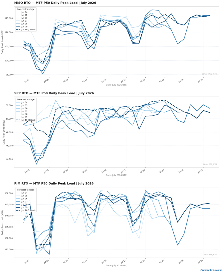
Peak Load Pressure Extends Across Key ISOs
In SPP, ECMWF ensemble-weighted temperatures are running 1 to 2 standard deviations above normal, with load tracking a similar departure from the P50 baseline. The P50 forecast consistently pushes above the 50 GW threshold during peak demand hours across the first two weeks of July, a level that historically corresponds with meaningful stress on the system.
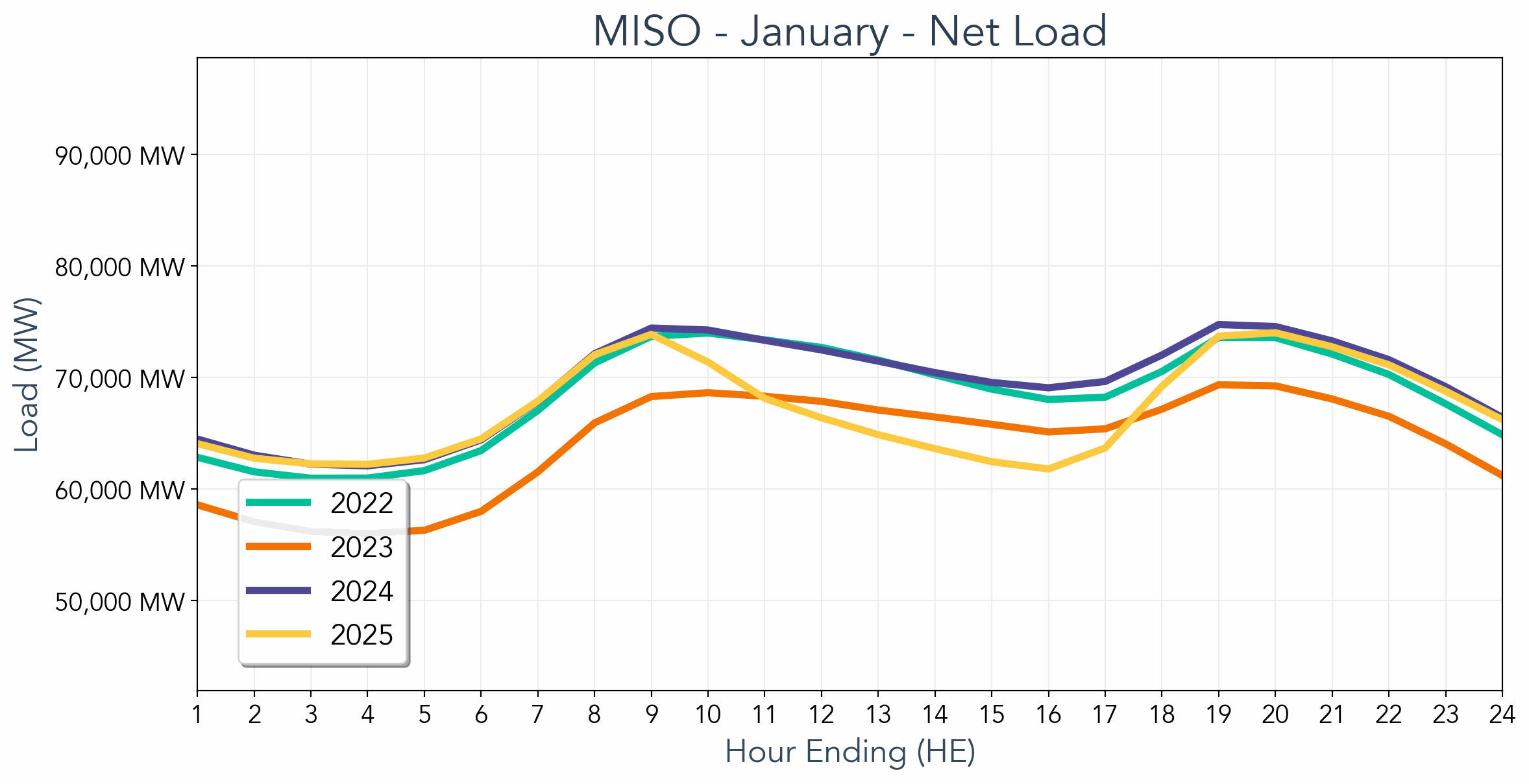
MISO tells a similar story. The P50 load sits anywhere from 0.5 to 1.2 standard deviations above the seasonal average through early to mid-July, with the forecast consistently clearing the 110 GW mark starting the week after the Fourth of July holiday. That's a notable signal, especially given how mild conditions have been heading into the summer.
PJM is also on the radar in early July. The P50 load sits anywhere from 0.5 to 1.6 standard deviations above the seasonal average through early to mid-July, with peak demand surpassing the 150 GW threshold a handful of times. When looking at the P90 for the same time period, peak load creeps closer and closer to that 160 GW point, possibly foreshadowing another record-breaking summer for this ISO.
CAISO shows the ECMWF ensemble P50 load more than 1 standard deviation above the average, starting the second week of July, with peak load sitting close to 40 GW. The P90 peak load for this time surpasses 42 GW, which is still far below the 52 GW record.
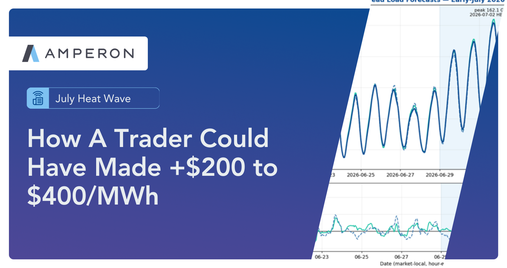
ERCOT also has a high risk of seeing some heat after July 4th. Monday, July 6th is starting to look like the start of the summer heat people have been waiting for, with the P50 0.5 standard deviations above normal and the temperature forecast 1.35 standard deviations above normal. Expect CP avoidance curtailment to start to really ramp up that week.
The Fourth of July holiday weekend may feel comfortable, but the week that follows looks like the setup for the first real heat event of the summer across the central U.S and potentially beyond. We'll be watching the ensembles closely as the pattern evolves.

.svg)


%20(3).png)
%20(2).png)
%20(1).png)


.png)


.avif)


.avif)

.avif)

.avif)

.avif)
%20(15).avif)
.avif)


.avif)

.avif)
.avif)


.avif)