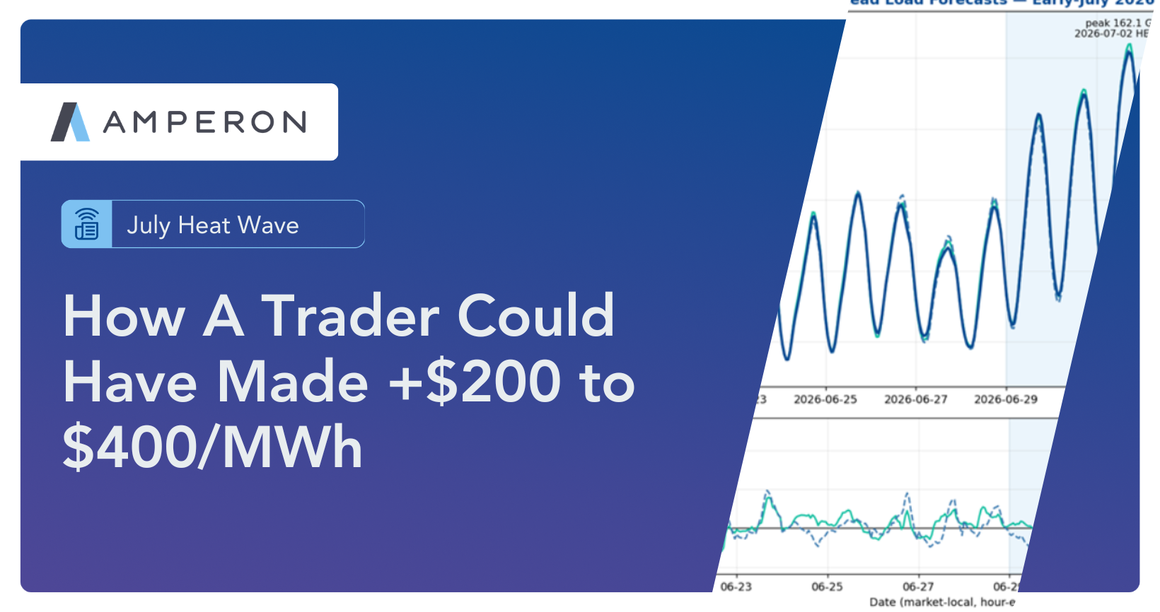
June 5th was a scorchah in ISONE. Temperatures surged past 90°F in Massachusetts and into the upper 80s throughout the rest of the Northeast, easily the hottest day of early summer so far. Most ISONE residents haven’t had time to install their window units. And yet, this beautiful hot and sunny day landed on a Thursday. This is a frustratingly familiar pattern of warm weekdays followed by cooler, rain-soaked weekends in the region.
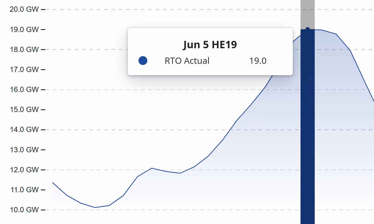
Because the heat arrived midweek, energy demand surged as people returned home from work in the late afternoon and early evening. ISONE demand peaked at 19 GW, marking the highest load we have seen so far this season.
Lagging Residential Response to Heat Spikes
As mentioned earlier, the heat probably came before ISONE residents could install their 50-pound window AC units. Just a week or so prior, temperatures were in the 40s and 50s with rain across the region. This rapid transition left people unprepared for the sudden heat, possibly impacting electricity usage.
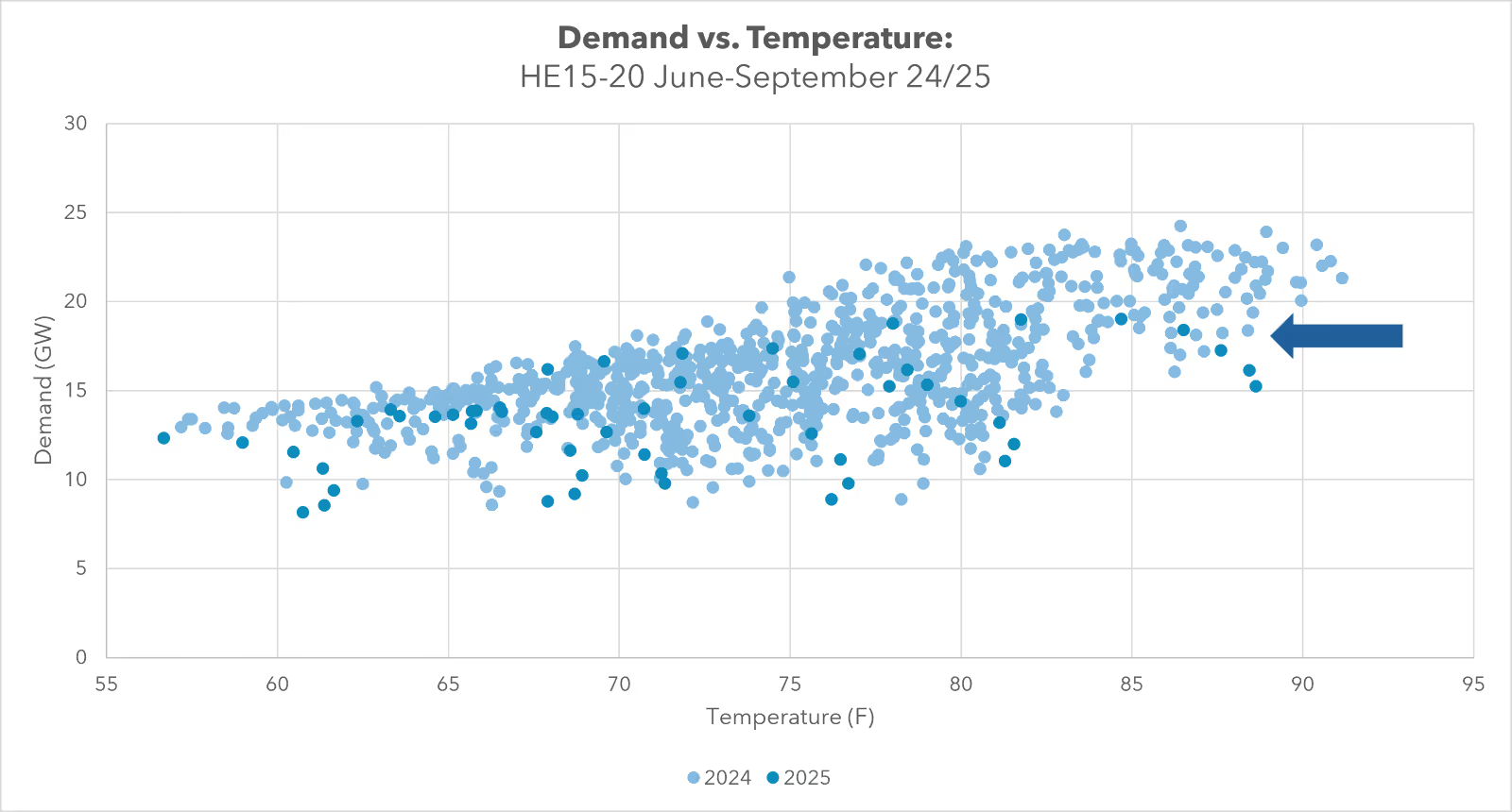
The scatter plot below may reflect this trend. Historically, when weighted ISONE temperatures reach the high 80s (as they did last Thursday), demand typically exceeds 20 GW. However, during peak heat last week, demand sat between 15–20 GW. Could this reduced demand be attributed to uninstalled AC units? It's a plausible theory. Rather than a true “demand shrink,” this may simply reflect a lagging residential response to an abrupt weather shift. People were truly melting in their apartments. However, they were too caught off guard to do much about it.
Demand Forecast- 0.93% APE at HE19
Amperon’s demand forecast performed exceptionally well, ending the day with an APE of just 0.12%, outperforming ISONE’s own low APE. The day’s MAPE for Amperon came in at a strong 0.93%, compared to ISONE’s 2.36%.
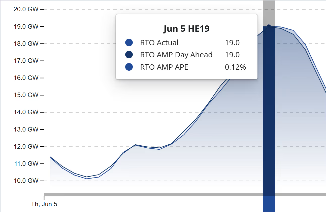
Net Demand Forecast- 0% APE at Peak Hours
Amperon’s net demand forecast also stood out, especially during the peak net load hours, achieving 0% APE at HE 19 and just 0.09% at HE 20, the hour of highest net demand. Real-time prices spiked across the ISO between 8:30–9:00 PM, likely driven by high net load coinciding with the solar ramp-down, leading to widespread negative DARTs.
Time will tell. If another wicked hot 90-degree weekday hits Boston soon, and based on recent patterns, we will have a chance to test this theory. Until then, we can only hope the next heatwave lands on a Saturday… so we can all escape to the beach. Alas.

.svg)


%20(3).png)
%20(2).png)
%20(1).png)


.png)


.avif)


.avif)

.avif)

.avif)


.avif)
%20(15).avif)

.avif)


.avif)

.avif)
.avif)


.avif)